By CAM LUCADOU-WELLS
A bid by Keysborough land-owners to carve up their green wedge property for housing development has been rebuffed by a council draft green wedge plan.
In the plan, council officers stated that low-density housing was not viable in the flood-prone Keys Road precinct area – bordered by Hutton, Springvale, Perry and Pillars roads.
It found the costs of the required major drainage infrastructure would be “prohibitive” and there were health and ecological risks from disturbing acid sulfate soils.
A landowners’ group, which sponsored studies to support their case, argued the necessary drainage works could be funded by the shrinkage of the minimum six-hectare lot sizes and the resulting “modest” increase in low-density housing.
Councillor Peter Brown had unsuccessfully moved for the area and part of the Bangholme East green-wedge precinct to be reclassified within the urban growth boundary in 2011.
He said there was little difference from Kingston’s green wedge, where ‘rural living areas’ of two-hectare minimum lots had been introduced.
He said the significant drainage issues could be fixed successfully, citing the Waterways housing estate in Kingston.
“Ultimately there must be increased subdivisions. The land’s too valuable to allow it to stay the way it is.
“Some like the idea of driving through the area in their 1980s Kingswood thinking this is nice countryside, just as it was when I was a child – that’s not the view of the majority of councillors.”
He said councillors had taken the “sharp edges” off an earlier version of the draft plan.
“The report has been intentionally left as open as possible to keep a doorway open for suggestions from the community and the landowners.”
Councillor Matthew Kirwan said it would be “irresponsible” to allow more residential subdivisions in a flood-prone area with acid soils, with the hastening risk of more frequent, intense flooding due to climate change.
“Even if you find a way for developers to pay for the drainage infrastructure now, the council will have to find a way to pay for maintaining it in the future.”
He praised the council’s “well-thought out” plan as a “reasonable balance between competing uses and values”.
In the draft plan, the council stated residential sub-divisions near Keys Road would alter the area’s amenity and topography, could have drainage impacts on other parts of the green wedge and lead to costly drainage maintenance bills.
It stated it could also create a precedent for further subdivisions in the green wedge.
The council proposed the precinct be rezoned Green Wedge Zone A, which would bring stricter controls prohibiting intensive animal husbandry, abattoirs and waste transfer stations.
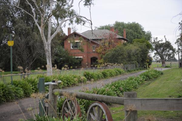
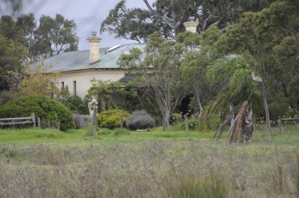
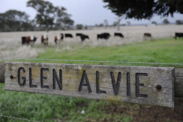
The precinct, one of seven demarcated under the green wedge plan, includes several historic homesteads associated with the early-settler Keys family such as Glen Alvie, Eversleigh and Holmwood farms.
The report states a band of Aboriginal-scarred trees from Keysborough-Lyndhurst may be possibly the state’s largest.
The council’s 3741-hectare green wedge – about 29 per cent of Greater Dandenong – covers parts of Keysborough, Bangholme and Lyndhurst.