Thousands of Victorians have been woken by an early morning earthquake that shook large parts of the state.
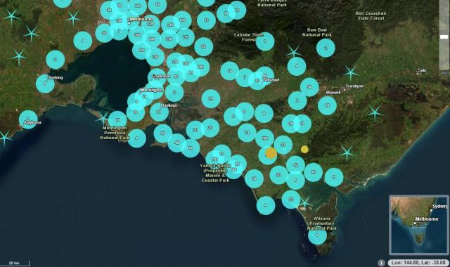
The 4.3 magnitude quake hit near Leongatha at 12.49am on Friday 9 February.
The tremors were felt as far north as Sunbury 38km northwest of Melbourne to Wilson’s Promontory National Park in the south, government agency Geoscience Australia said.
There was no threat of a tsunami in the aftermath of the quake, the Bureau of Meteorology reported.
More than 4900 people reported feeling the quake which had a depth of eight kilometres at the epicentre in the town of Meeniyan.
The quake was the biggest to hit the state since a 5.0 magnitude earthquake rattled residents in southwestern Victoria in October, the Seismology Research Centre’s chief scientist Adam Pascale said.
“This is certainly getting to the magnitude where you expect some minor damage to appear but we haven’t heard any reports,” Mr Pascale told 3AW.
“The seismologist said the state has experienced more earthquakes in the past couple of years than in the decade or two before.
“It’s still within the normal range of activity for our region in the world,” he said.
The largest earthquake in Victoria’s history with a magnitude of 5.9 occurred in 2019 resulting in thousands of insurance claims for damages with tremors reaching as far away as Canberra, Sydney and Adelaide.