A proposed cemetery near Dandenong Creek would have to be raised about nine metres to withstand potential floodwaters, says a local flood historian.
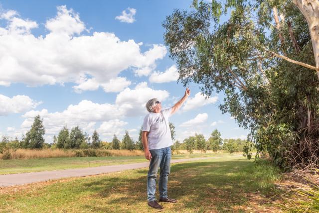
Alan Hood says the proponent Southern Metropolitan Cemetery Trust would have to replicate its elevation of the Bunurong cemetery park in Bangholme.
In this case at 1564 Heatherton Road, it would mean a vast mound of fill about 1 kilometre wide, 1.35 kilometres long and a central depth of about 9 metres.
It would tower over the nearby “flood-prone houses built down the creek banks”.
“Bulldozing the native bushland and bringing in hundreds of truckloads of potentially contaminated fill in per day would be traumatic for the thousands of residents near the creek.”
Mr Hood says the proposed cemetery would act like a “massive bathplug” in the bowl-like flood basin.
“Future floods would result in higher water levels, flooding more houses upstream.”
Heatherton Road itself was an “unresolved flood issue” and needed to be raised three metres, Mr Hood said. It closed seven times in 2003-04 due to flooding.
An unelevated burial ground – at a level below Heatherton Road – would lead to “body washaways”.
Mr Hood has catalogued seven of the greatest floods in Dandenong, including their heights and rainfall levels.
Many residents would not know the area was flood-prone, he says. The great floods that have consumed Dandenong in the past such as 1934 and 1952 are beyond many living memories.
But Mr Hood warns the site owner Melbourne Water – which is also the floodplains’ manager – not to ignore history.
The worst of the floods was in 1934, following 316 millimetres of rain.
The waters rose to an astonishing height of 7.6 metres at Dandenong railway viaduct and flowed one metre above Princes Highway bridge, he says.
In echoes of the current tragic Queensland floods, nearly 1000 homes in the Carrum Swamp extending from Dandenong to Mordialloc and Frankston were surrounded by water.
Fishermen in boats plucked people off their roof tops. Some 700 families were forced to flee.
Mr Hood says a Royal Commission two years later concluded that development in the flood-prone Dandenong Valley was the cause.
It sent a clear message to stop building on the flood plains, he said.
A repeat of those rains 89 years ago will flood the “lowest houses” near to the proposed cemetery site.
Greater Dandenong Council has also voiced concerns about the cemetery plan, including its “hydrological” impact.
According to the State Government, Melbourne Water, as the floodplains manager, has to ensure adequate flood mitigations during construction and long-term before the application would proceed.
Melbourne Water is currently negotiating with SCMT about the proposed burial ground.
It has not responded to Star Journal’s inquiries about the cemetery’s design, elevation, and its impact on flood risks.
SCMT has not yet responded to inquiries.