The efficacy of several drainage systems in the City of Casey has been questioned by locals after significant rainfall caused major road closures across the municipality.
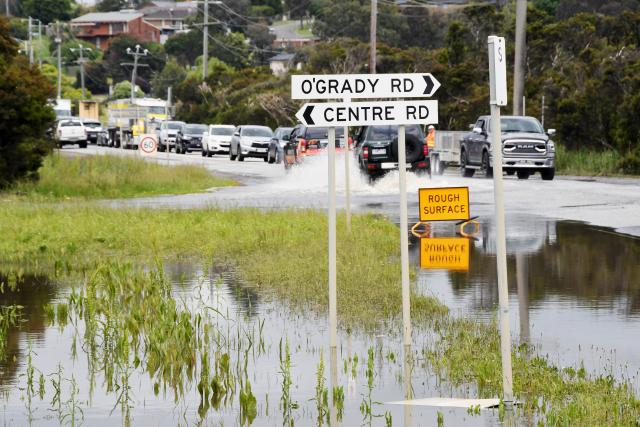
Heavy rainfall throughout October saw Grices Road in Berwick and Hallam South Road, near Hallam Station logged extensively by floodwaters, causing lengthy road closures on several occasions.
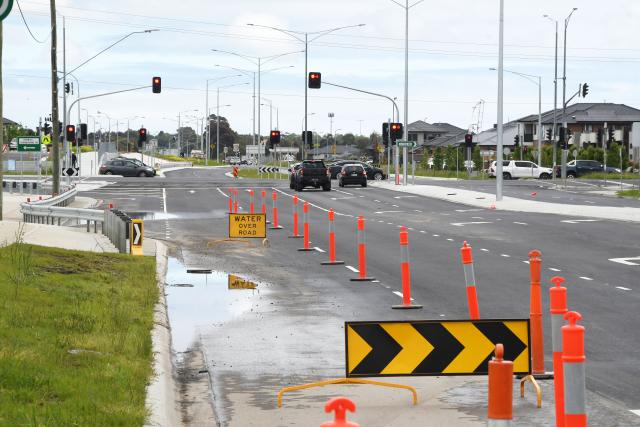
Westbound lanes on Grices Road near Viewgrand Drive were closed due to flooding throughout periods of peak rainfall in October and early November.
It comes just months after the same westbound lanes were upgraded as part of duplication project.
City of Casey city design and construction manager Trevor Griffin said the flooding on Grices Road was caused by high water levels in the Melbourne Water creek, as well as a temporary causeway about 100 metres downstream of Grices Road, which is part of a South East Water sewer renewal project.
“The heavy and ongoing rainfall has resulted in the causeway creating a small dam, which is restricting water flow within the creek and raising water levels above what is expected,” Mr Griffin said.
“We have been liaising with Melbourne Water and South East Water and they have confirmed they will be removing the causeway this Wednesday 9 November.”
The drainage system on Grices Road normally discharges water into the Melbourne Water creek, adjacent to the Bridges East of Clyde Road over the wetland reserve, and is designed for the area’s predicted rainfall, including potential flooding events, Mr Griffin said.
However, he said the record rainfalls throughout October has saturated the ground which is preventing water from Grices Road discharging into an already full creek.
“Council is currently investigating options to use adjacent vacant public land as a basin with holding ponds to redirect some water off Grices Road during times of flood,” Mr Griffin said.
“Detailed designs will be undertaken and further discussions with the adjacent land owners will be held.”
Meanwhile, in the last month, Hallam South Road was closed for a total of six days between 29 and 31 October, and 3 and 5 November due to high rainfall and flooding over the road.
A Department of Transport spokesperson said the Hallam South Road drainage system was found to be adequate.
“Above average rainfall has caused hundreds of roads to close across the state, including roads with no recent history of recurrent flooding like Hallam South Road,” the spokesperson said.
“Crews continuously monitor the road network and on both occasions where Hallam South Road was closed, flood water subsided within days.
“After high rainfall our crews work to clear debris from roads, carry out safety inspections and reopen them as quickly as possible.”
Members of the community who come across flooded or damaged roads are encouraged to report them by calling VicRoads on 13 11 70.
According to SES Victoria’s City of Casey Flood Guide from August 2020, about 14 per cent of the City of Casey is at risk of flooding from rivers and creeks overflowing.
Majority of the municipality is also at risk of flash flooding, according to the report.